Executive Secretary

9th International Scientific Conference on Agricultural Development and Sustainability
10th Symposium of Agronomy
Abstract
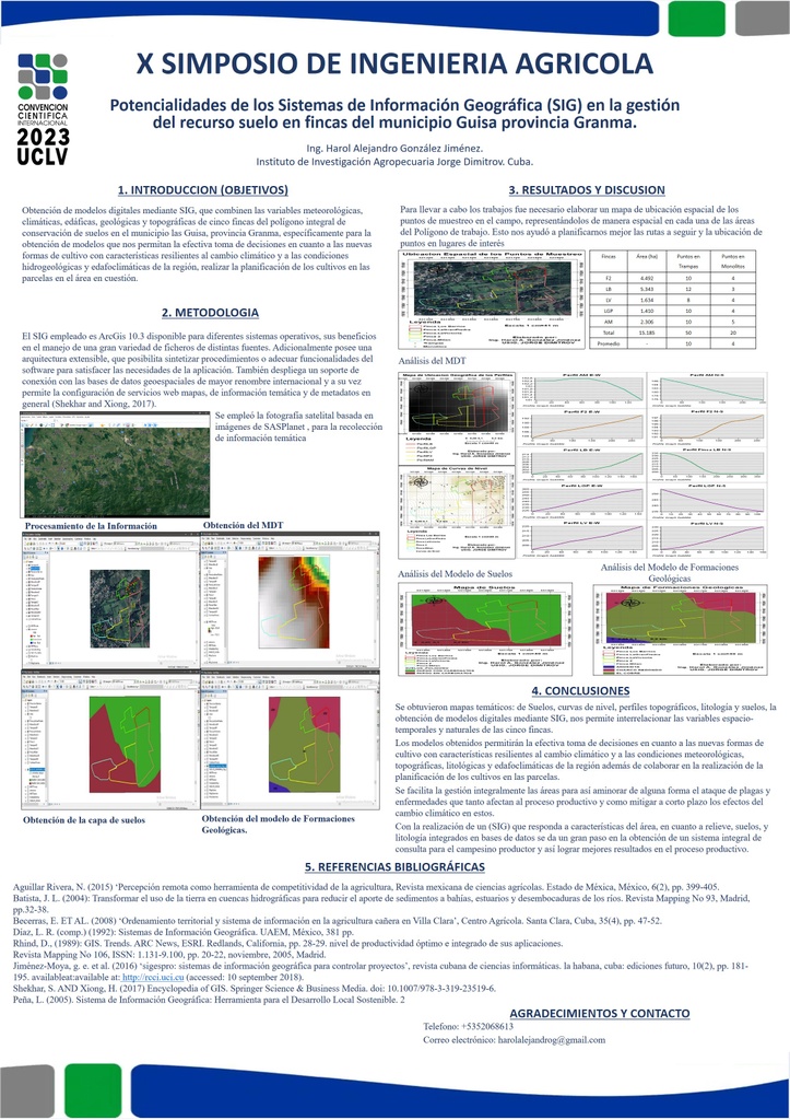
Geographic Information Systems (GIS) contribute to the rapid solution of various problems that arise in agricultural production, such as the determination of areas with the greatest physical-geographical and edaphoclimatic aptitudes for different crops. The objective of this work is to obtain digital models using GIS, which combine the meteorological, climatic, edaphic, geological and topographic variables of five farms of the comprehensive soil conservation polygon in the Las Guisa municipality, Granma province. Visits were made to the farms to establish their geographical location and observe the characteristics of the soil. The rainfall and climate balances were consulted at the Provincial Delegation of Hydraulic Resources and at the Provincial Meteorology Center of Granma respectively. The information processing was carried out in the ArcGis 10.3 program to prepare the digital models. The Digital Elevation model (MDT), the Soil Types model, the Geological Formations model and the Meteorological model were obtained for each farm, the resulting information was integrated and the models were correlated to generate a final integrated model characteristic of each estate. It is concluded that the use of GIS allowed obtaining models for soil resource management and decision making in the agroecological management of farms.
Keywords: GIS, farm, digital models
Resumen
Los Sistemas de Información Geográfica (SIG) contribuyen a la solución rápida de diversos problemas que se presentan en la producción agrícola como la determinación de las áreas con mayores aptitudes físico-geográficas y edafoclimáticas para diferentes cultivos. El presente trabajo tiene como objetivo la obtención de modelos digitales mediante SIG, que combinen las variables meteorológicas, climáticas, edáficas, geológicas y topográficas de cinco fincas del polígono integral de conservación de suelos en el municipio las Guisa, provincia Granma. Se realizaron visitas a las fincas para establecer su ubicación geográfica y la observación de las características del suelo. Se consultaron los balances pluviométricos y climáticos en la Delegación Provincial de Recursos Hidráulicos y en el Centro Provincial de Meteorología de Granma respectivamente. El procesamiento de la información se realizó en el programa ArcGis 10.3 para elaborar los modelos digitales. Se obtuvo para cada finca el modelo de Elevación Digital (MDT), el modelo de Tipos de Suelos, el modelo de Formaciones Geológicas y el modelo Meteorológico, se integró la información resultante y se correlacionaron los modelos para generar un modelo integrado final característico de cada finca. Se concluye que el uso de SIG permitió la obtención de los modelos para la gestión del recurso suelo y la toma de decisiones en el manejo agroecológico de las fincas.
Palabras clave: SIG, finca, modelos digitales
About The Speaker

Ing. Harol Alejandro González Jiménez

Discussion