Executive Secretary

9th International Scientific Conference on Agricultural Development and Sustainability
10th Symposium of Veterinary Medicine and Zootechnics
Abstract
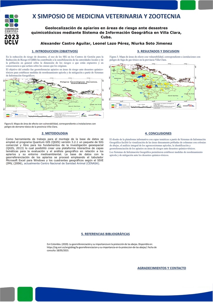
The honey bee depends on the conditions of the environment for its optimal development; its food base must be in healthy and balanced ecosystems, with diverse and abundant blooms, as well as abundant water. The objective of the study was to georeference apiaries in areas at risk from chemical-toxic disasters to establish beekeeping reorganization and mitigation measures based on Geographic Information Systems. The work was carried out in Villa Clara province, Cuba. 100% of the apiaries were identified and an information platform was created for their location in the agro-ecosystem. The Quantum GIS (QGIS, 2013) version 3.2.1 program was used, a commercial and free GIS package for the foundations of geospatial research that made it possible to create an interactive platform of thematic layers for the evaluation and geographic analysis of apiaries and their environmental setting. The design of the information platform with thematic layers based on Geographic Information Systems facilitated the visualization of areas densely populated with hives with bee colonies, the identification and georeferencing of apiaries in risk areas in the event of chemical-toxic disasters and allowed establishing beekeeping rearrangement and mitigation measures in the face of chemical-toxic events.
Resumen
La abeja melífera depende de las condiciones del medio para su desarrollo óptimo, su base alimentaria debe estar en ecosistemas sanos y en equilibrios, con floraciones diversas y abundantes, así como abundante agua. El objetivo del estudio fue georreferenciar apiarios en áreas de riesgo ante desastres quimico-tóxicos para establecer medidas de reordenamiento apícola y de mitigación a partir de Sistemas de Información Geográfica. El trabajo se realizó en la provincia Villa Clara, Cuba. Se identificaron el 100% de los apiarios y se creó una plataforma informativa para la ubicación de estos en el agro ecosistema. Se empleó el programa Quantum GIS (QGIS, 2013) versión 3.2.1 un paquete de SIG comercial y libre para los fundamentos de la investigación geoespacial que posibilitó crear una plataforma interactiva de capas temáticas para la evaluación y el análisis geográfico de los apiarios y su entorno medioambiental. El diseño de la plataforma informativa con capas temáticas a partir de Sistemas de Información Geográfica facilitó la visualización de las áreas densamente pobladas de colmenas con colonias de abejas, la identificación y georreferenciación de los apiarios en áreas de riesgos ante desastres químico-tóxicos y permtieron establecer medidas de reordenamiento apícola y de mitigación ante los eventos químico-tóxicos.
About The Speaker

Leonel Lazo Pérez

Discussion